


Ausangate Trek, what matters before you choose a route
The Ausangate Trek is a high-altitude circuit in the Vilcanota mountain range, built around the Ausangate massif, which rises to 20,945 ft (6,384 m). Depending on the version you choose, the trek usually takes between 4 and 7 days and crosses passes that often rise above 15,748 ft (4,800 m). It is a demanding route because of altitude, cold, wind, and several consecutive days above 13,120 ft. It suits travelers who arrive with good acclimatization, enough time in Cusco, and a clear interest in remote mountain trekking rather than a short hike or a route centered on archaeological sites.
Table of Contents
The Ausangate feels different from other well-known routes in Cusco because the center of the experience is not a ruin or a citadel waiting at the end. The center is the mountain itself and everything that lives around it: glaciers, lakes, bofedales (Andean wetlands), herds, hot springs, cold campsites, and communities that still inhabit the territory at high elevation.
| 20,945 ftAusangate summit | 4 to 7 daysMost common duration | May to SeptemberMost stable window | Upis, Pacchanta, TinquiCommon access points |
That changes how you read the trek. What matters here is the relationship between the body and the altitude, the real distance between campsites, the hiking pace, and the way weather can reshape an entire day. If your trip is built mainly around Machu Picchu, this is worth understanding early, because the Ausangate is a mountain circuit in its own right, not a route designed around a final archaeological arrival.
What is the Ausangate Trek and which traveler does it suit best
The Ausangate Trek is a multi-day circuit in the Vilcanota mountain range, southeast of the city of Cusco. It is considered one of the most demanding routes in the region because of the combination of altitude, climate, high passes, and remoteness. It is also one of the most complete for those who want to walk through raw landscape with less tourist pressure and a clearer read of the high-Andean territory.
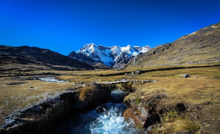
It suits travelers who already accept cold nights, campsites, several hours of walking per day, and a more direct relationship with the mountain. It also works well for those who value glacial lakes, Andean pastoral life, and the quiet of a route less saturated than the Salkantay or Inca Trail.
| A good fit if… | Worth considering another option if… |
|---|---|
| You want real high-altitude trekking, fewer people, and continuous landscape over several days. | Your priority is reaching Machu Picchu on foot or doing a more archaeological route. |
| You arrive with solid fitness and enough margin to acclimatize in Cusco. | You are short on time and were planning to start almost immediately after landing. |
| You accept cold nights, basic facilities, very patchy signal, and less comfortable logistics throughout. | You prefer a gentler hike or one with more consistent services along the route. |

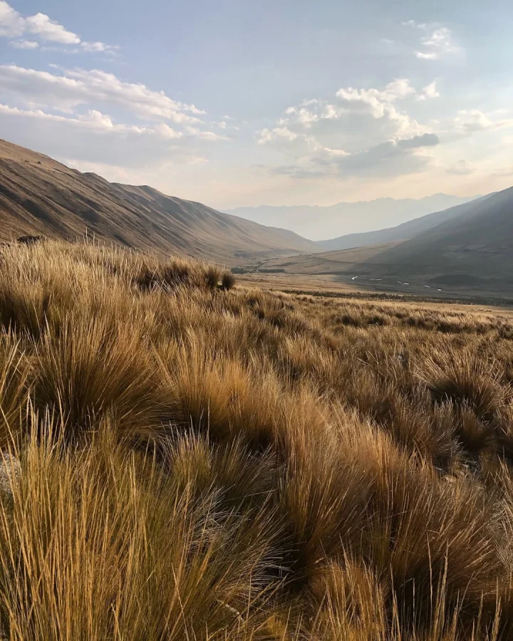
Alpacas and high-altitude grasslands in the Ausangate area
Ausangate as a sacred mountain
The Ausangate is a sacred mountain for several Andean communities. It is recognized as an apu, a protective presence linked to water, fertility, and the balance of the territory. That dimension does not sit apart from the trek. It is felt in the landscape and in how the route is lived: pastoralism, offerings, hot springs, wetlands, and a daily relationship with altitude.
Did you know?
The name Ausangate likely comes from the ancestral term Awsanqati, connected to both Quechua and Aymara, and is generally understood as a reference to the rocks, fissures, and cavities of the massif. The name conveys the idea of a living mountain, respected and deeply tied to the identity and life of the territory.
Where is the Ausangate Trek and where does it begin?
The Ausangate glacier is in the Vilcanota mountain range, southeast of the city of Cusco, within the area of Ocongate, Tinqui, Upis, and Pacchanta. The exact starting point varies depending on the version chosen by the operator. Some routes depart from Upis, others use Pacchanta as an entry or closing point, and several pass through Tinqui as a logistical reference before the final rural section.
| Access point | Time from Cusco | Practical read |
|---|---|---|
| Pacchanta | ~4 to 5 hrs | Widely used for hot springs, shorter hikes, and circuit closings. |
| Upis | ~4 to 5 hrs | Frequent starting point for classic circuits. |
| Tinqui | ~3.5 to 4 hrs | Common logistical hub before the final rural section. |
| Ocongate | ~3 hrs | Functions more as a route reference and supply point than a direct trek starting point. |
Routes and durations: there is no single version of the Ausangate Trek
The first common mistake is assuming the Ausangate Trek always follows the same format. It does not. There are compact versions, classic circuits, and longer routes with more lakes, more hot springs, or combinations with Vinicunca and other color mountains. The difference is not just one extra day. The pace changes, accumulated physical load changes, and so does how the body responds to altitude.
| Version | Duration | Approx. distance | Demand level | Best suited for |
|---|---|---|---|---|
| Compact | 4D / 3N | Variable | High | Those with less time who arrive already acclimatized and with a solid pace. |
| Classic | 5D / 4N | ~40 to 47 mi (65 to 75 km) | High | The most balanced version for those who want the full circuit without rushing the daily stages. |
| Extended | 6D / 5N or 7D / 6N | Variable | High, but better distributed | Those who want to walk with more breathing room, add detours, and reduce the feeling of racing through the route. |
Classic Ausangate Trek (5D/4N)
The 5-day, 4-night version is the one that best balances distance, campsites, and landscape. It is still a serious route, but it distributes effort more evenly and leaves more space to read the lakes, passes, hot springs, and weather shifts without feeling like everything is happening too fast.

Ausangate Trek + Sibinacocha (7D/6N)
The Qhapaq Ñan route is a network of ancient paths that connected different regions of the Inca Empire. One of the most compelling sections leads toward the Ausangate glacier, the sacred mountain of the Incas located in the Cusco region of Peru. This extended version adds Sibinacocha Lake and covers a broader stretch of the high-altitude Andean corridor.
Rainbow Mountain, Red Valley and Ausangate Trek (2D/1N)
This variant works for those who want to touch the Ausangate environment while adding Vinicunca (Rainbow Mountain) and Red Valley in a shorter outing. The altitude is still significant and the hiking is felt, especially without proper acclimatization. It works better as a compact, visually impactful route than as a substitute for the classic circuit.
Real difficulty: the route is hard because of altitude, high passes, and accumulation
The Ausangate Trek is a demanding hike. The difficulty does not come from technical climbing moves. It comes from a different combination: many hours above 13,120 ft (4,000 m), high passes, cold, wind, tough campsites, and several consecutive days where the body burns more energy just sustaining itself at altitude.
| Factor | Reference | What it means in practice |
|---|---|---|
| Route altitude | Above 13,120 ft (4,000 m) for much of the route | Breathing is harder, pace slows, and fatigue arrives earlier. |
| High passes | 15,748 to 16,732+ ft (4,800 to 5,100+ m) | This is where it becomes very clear whether you arrived properly acclimatized or not. |
| Terrain | Puna grassland, trail, rock, mud depending on season | No climbing required, but steady legs and stable footing matter throughout. |
| Nights and climate | Hard cold and wind | A poor night’s sleep or badly planned layers shows up clearly the next morning. |
Warning: Flying in from Lima and heading into the Ausangate with almost no acclimatization is a poor approach. The sensible minimum is 2 to 3 days in Cusco before starting, with progressive adaptation and without overexerting yourself the day before.
Climate and best season: the dry window is key, but not every month carries the same weight
In Ausangate, weather shifts quickly. Strong midday sun, dry afternoon wind, hard nights, and the possibility of rain, hail, or snow outside the most stable window. The most reliable period generally concentrates between May and September, with October still reasonable in many years. Between November and March, the route becomes more uncertain due to rain, mud, cloud cover, and more uncomfortable passes.
| Period | Conditions | Practical read |
|---|---|---|
| May | Solid start of the dry window | A very good option for good weather without peak demand pressure. |
| June to August | Driest conditions, coldest nights | Excellent visibility. Demands a better sleeping bag, more serious layers, and early booking. |
| September and October | Good balance between stability and less pressure | Among the best windows for making a clear-headed decision. |
| November to March | More rain, more mud, more cloud cover | Viable only for those who accept much higher variability and a lower visual reward. |
How to get to the Ausangate Trek
From Cusco, access is typically by road heading southeast, passing through Ocongate and then toward areas like Tinqui, Pacchanta, or Upis depending on the trek variant. With an organized tour, this transfer is usually handled from the start. Independently, the logistics become more fragmented: interprovincial or shared transport, then a local taxi or shared vehicle to the final access point.
| Option | Route / Access | Estimated time | Key notes |
|---|---|---|---|
| With operator | Cusco to Upis / Pacchanta / starting point per route | ~4 to 5 hours | The most organized approach if you do not want to spend energy on transport combinations. |
| Independently | Cusco to Ocongate / Tinqui, then local taxi or shared vehicle to final access | Variable | Works if you are already comfortable with rural transport in the Cusco area and flexible with timing. |
Signal, bathrooms, water, and waste management
| Aspect | What to expect in Ausangate |
|---|---|
| Signal / mobile data | Very patchy or nonexistent on several sections. Do not plan to rely on messaging apps. Download offline maps before departing. |
| Bathrooms | Basic facilities at some campsites or communities. Serious operators may provide a portable or chemical toilet. |
| Water | With an operator, usually handled through boiled or filtered water. Independently, you must treat it yourself. |
| Waste | Carry your trash out and minimize packaging. On a route like this, the difference between a responsible group and a careless one becomes visible quickly. |
What you will encounter on the Ausangate Trek
The route builds its strength because it does not rest on a single iconic point. It assembles day by day through glaciers, lakes, hot springs, and high-Andean wildlife. These are some of the elements that give the route its strongest visual and territorial weight.
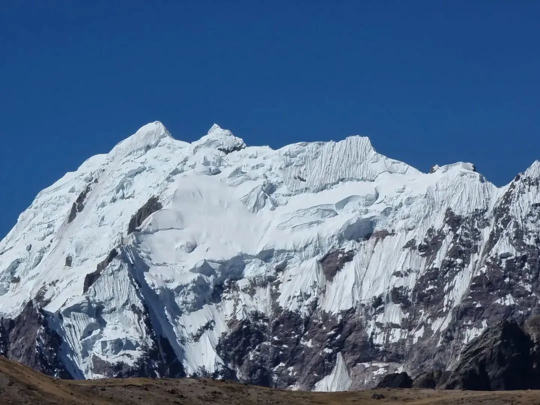
The Ausangate glacier
The snow-capped summit organizes the entire circuit. It is present on the horizon, in the water flowing down toward lakes and streams, and in the symbolic reading of the territory as the dominant apu of the area.
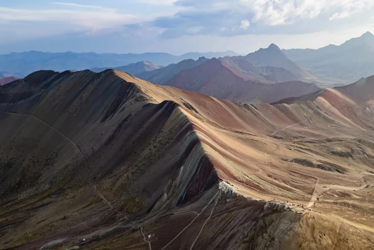
Rainbow Mountain (Vinicunca)
Along the route, it is possible to stop to take in the remarkable striped mountain, with its multicolored mineral layers unique in the Andean range.
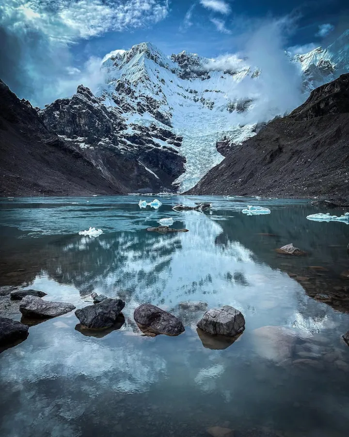
Glacial lakes
These are one of the strongest visual markers of the trek. The color shifts depending on light, bottom depth, and the fine glacial sediment suspended in the water.

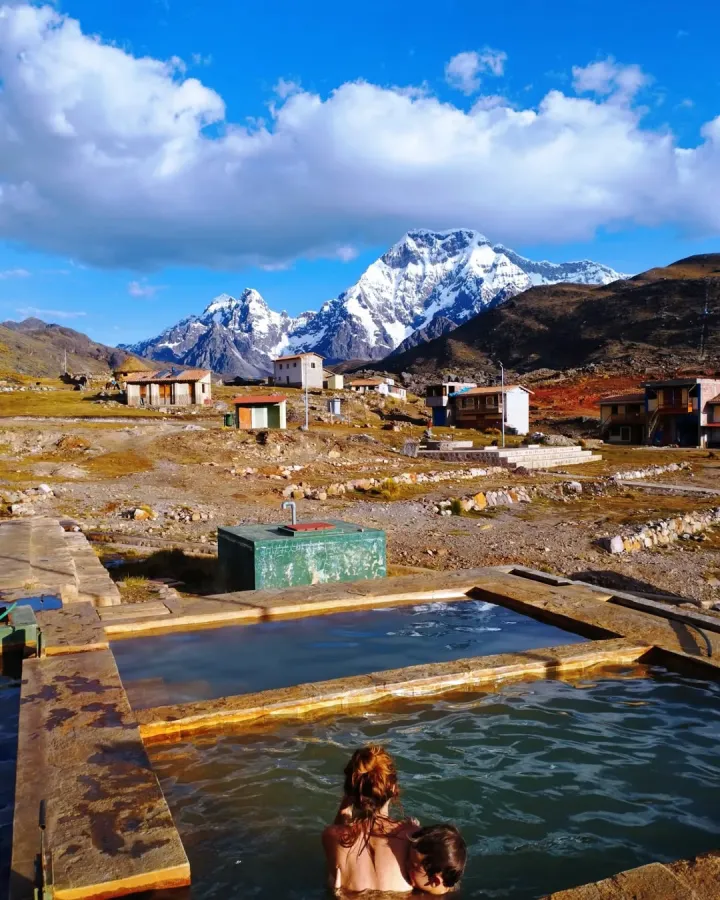
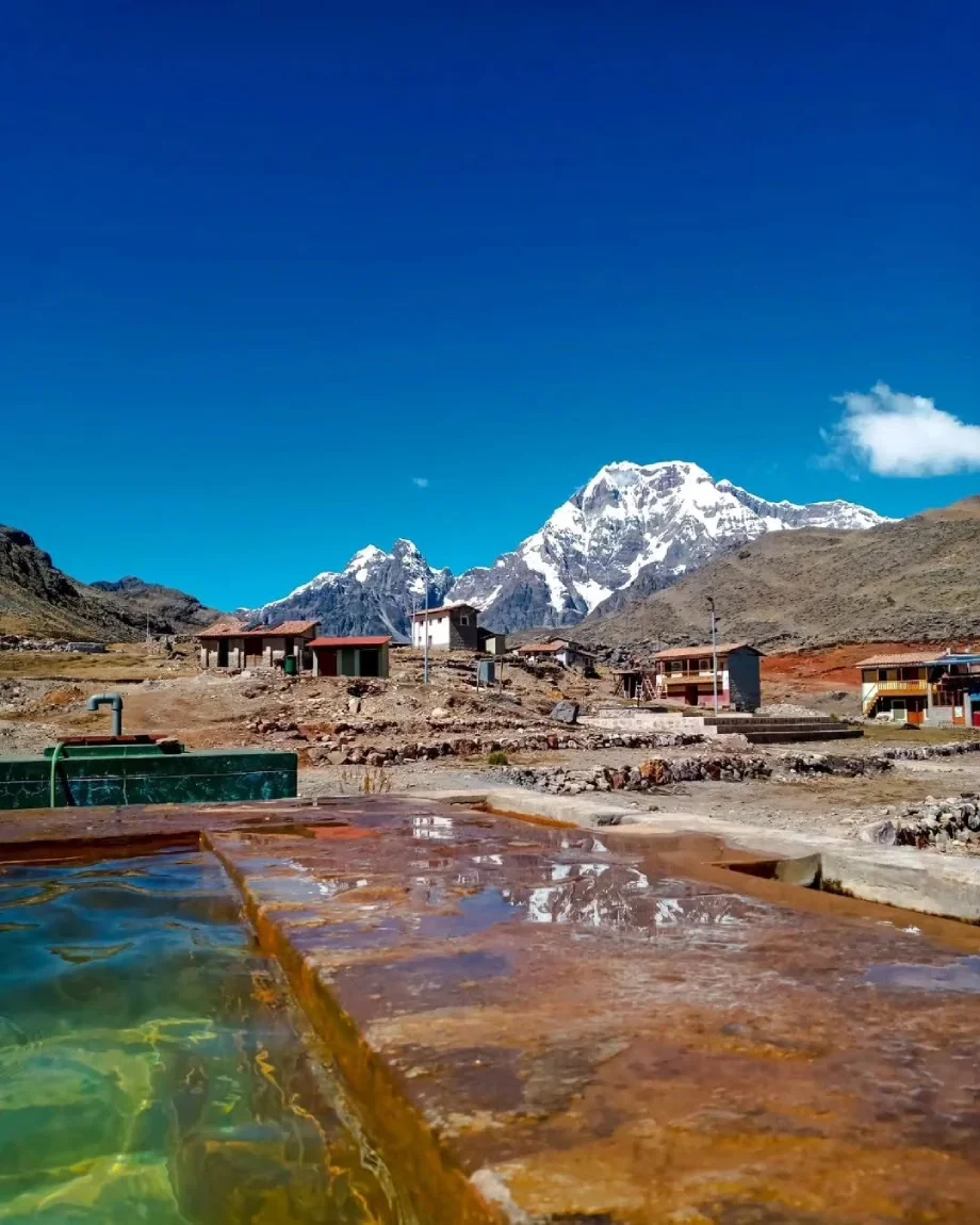
Pacchanta hot springs
For many trekkers, these are one of the most welcome stops on the circuit. After several days of cold and elevation gain, the body immediately understands why this break matters.
Other Guides That Help Before Booking the Ausangate Trek
What a good service for the Ausangate Trek should include
On a route this demanding, choosing by lowest price usually cuts something important: logistics, warmth, food, safety, or timing. Worth looking at this carefully before booking.
| Item | What to verify |
|---|---|
| Guide | Professional guide with real high-altitude experience and solid altitude management skills. |
| Transport | Transfers from Cusco properly handled to the starting point and a clear return plan. |
| Equipment | Tents, sleeping pads, cooking gear, safe water, oxygen, and a first aid kit. |
| Meals | Adequate food for altitude demands, early breakfasts, and good hydration support. |
| Local logistics | Which community fees or local access charges are included and which are not. |
Important note:
The layering system is a technique for maintaining warmth and comfort on the mountain. It involves wearing several clothing layers that can be added or removed depending on conditions and hiking pace.
What to pack for the Ausangate Trek
In Ausangate, a carefully chosen pack works better than an inflated one driven by anxiety. Altitude, cold, and accumulated weight mean that every unnecessary item is felt more.
- Passport or personal ID and some cash in soles.
- Broken-in trekking boots with solid grip.
- Layering system: thermal base layer, fleece mid-layer, and waterproof outer shell.
- A serious warm jacket for afternoons and nights.
- Wool hat, gloves, UV-protective sunglasses, and high-SPF sunscreen.
- Trekking poles.
- Water bottles or hydration bladder.
- Easy-to-digest snacks.
- Headlamp and power bank.
- Sleeping bag rated for cold nights, if not provided by your service.
- Personal medications and any altitude prevention only with medical guidance.
Important note: The goal is not to bring more things. It is to bring the right things. On a trek like this, a good layer, tested footwear, and an adequate sleeping bag matter far more than several accessories you will never use.
Entrance fees and local charges
The Ausangate Trek does not operate under the Cusco Tourist Ticket system or a rigid structure like the Inca Trail. Depending on the route chosen, there may be local or community access fees, and those amounts are worth confirming before departing because they can vary between communities, seasons, and control points.
If you are going with an operator, ask clearly which payments are included. If you are going independently, do not assume the route works the same way at every entry point.
Biodiversity
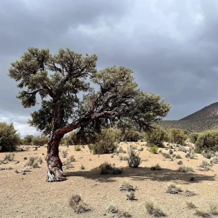
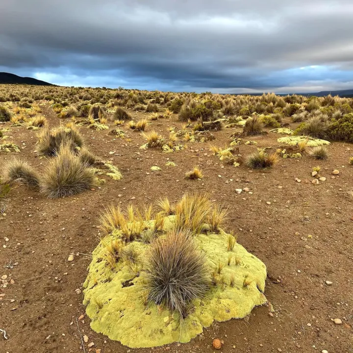
The Ausangate area is one of Peru’s most significant natural environments, not only for its landscape but for its rich biodiversity. The following are the most representative flora and fauna found in the Ausangate territory.
Flora

Fauna

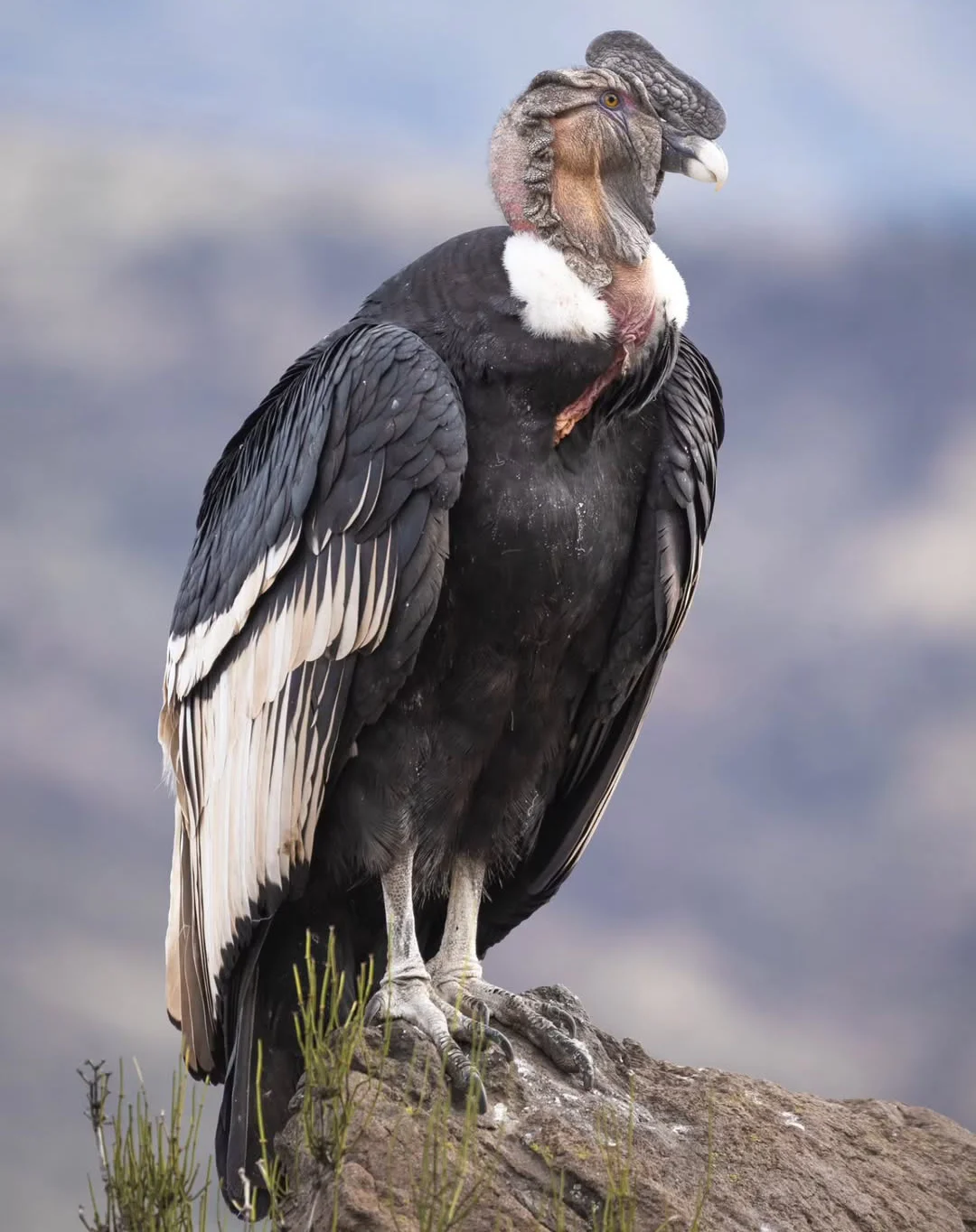
Andean condor is one of the largest birds in the world and inhabits the rocky zones of the Ausangate massif.
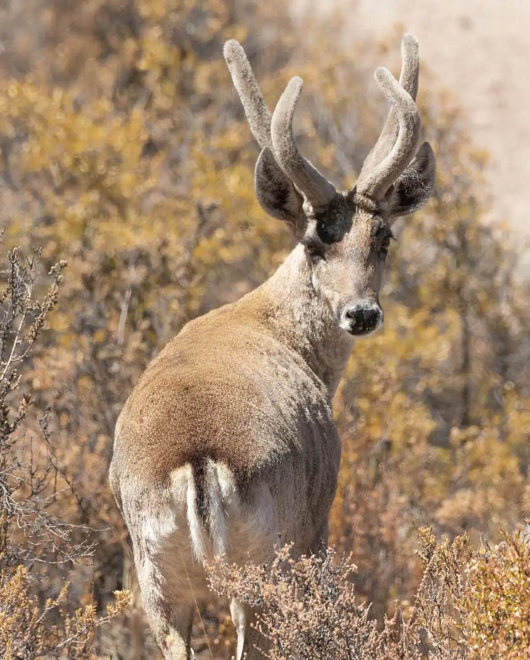
Taruka (Andean deer) is an Andean deer that inhabits the high, rocky zones of the Ausangate area.

Choosing the Ausangate Trek well changes the entire experience
Ausangate demands a more honest decision than other Cusco routes. What weighs most here is how you arrive at the trek: acclimatization, gear, service type, and a realistic read of your altitude tolerance. When that is properly sorted, the circuit opens up differently. You walk with more air, you read the landscape better, and you let the mountain do its work without fighting your own body from the first step.
If you want to work out which version of the Ausangate Trek suits you best, which logistics to close in advance, and how to align access points, climate, and gear, Inkayni Peru Tours can help you frame it with more clarity from the start.
Frequently asked questions about the Ausangate Trek
Is the Ausangate Trek a good idea for beginners?
It is not usually the best introduction to high-altitude trekking. A very well-prepared beginner can manage it, but arriving with solid fitness and real acclimatization in Cusco is essential.
Do you need a tourist ticket to enter the Ausangate Trek area?
No, the Cusco Tourist Ticket is not required for the Ausangate Trek route. It is worth noting that if you enter via the Pacchanta village, there is a local access fee that varies by nationality. Peruvian nationals pay approximately S/5 (around $1.50 USD) and foreign visitors pay approximately S/10 (around $3 USD). Access conditions and fees can change, so it is worth confirming current amounts before departing.
How does it compare in difficulty to other Cusco treks?
It tends to feel harder than mid-level routes like the Lares Trek, and depending on the version, it can feel as demanding as or more demanding than standard Salkantay formats, primarily because of the sustained altitude and remoteness.
Can I do it independently?
Some variants can be done independently, but improvising it is not a good approach. The route is remote, signal is weak, and the logistical details carry real weight. For most people, an operator orders the experience considerably better.
How many acclimatization days should I give myself before starting?
The sensible approach is 2 to 3 days in Cusco or the Sacred Valley before beginning. With less margin, the body arrives more exposed.
Is altitude sickness a real concern here?
Yes, it is one of the central factors of the trek. Good hydration, a consistent pace, rest, and listening to your body matter far more than any theoretical shortcut. This guide does not replace medical advice — consult a doctor if you have relevant health history.
What is the best time of year to do the Ausangate Trek?
May to September generally offers the most stable window. September and, in many years, October provide a particularly good balance between weather conditions and lower pressure.
Do you always sleep in a tent?
In most classic circuits, yes. Some very specific versions may combine a different arrangement, but Ausangate is typically experienced as a camping route.
Do I need to bring my own sleeping bag?
It depends on the service. Many operators offer rental separately. Worth confirming before paying, along with the temperature rating and the condition of the equipment.
Is there safe drinking water during the trek?
With an operator, generally yes, through boiled or filtered water. Independently, you must treat it yourself. It is not safe to assume that any water source along the route is drinkable without treatment.
Is it worth doing if I have already done Rainbow Mountain or the 7 Lakes?
Yes, because the Ausangate Trek is a different scale of experience. It does not reduce to a viewpoint or a single lake. It is lived as a complete mountain circuit, with more time, more exposure, and much more territory.
Escrito por

Shared:


If you liked this article and the information you found, give us 5 stars!
 (Ninguna valoración todavía)
 Loading...