


Table of Contents
The Choquequirao history intrigues any traveler who hears its name for the first time. How is it that an Inca citadel the size of Machu Picchu remained hidden among mountains for centuries? Why did its terraces, temples, and pathways only begin to reveal themselves in recent decades?
Choquequirao is often described as mysterious because much of the site remains unexcavated and because its modern fame came late, after centuries of local memory, scattered colonial references, 19th-century exploration and Hiram Bingham’s 1909 visit. Understanding that layered past makes the trek feel less like a hike to ruins and more like a walk through a still-unfinished chapter of Inca history.
| 15th-16th c.Inca occupation period | Vilcabambastrategic mountain region | 1909Bingham documents the site | 30-40%commonly cited as excavated |
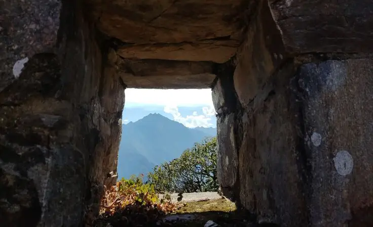

Routes such as the Inca Trail, the Salkantay Trek or the Lares Trek usually reveal their character through the route itself, but Choquequirao gathers much of its weight at the end.
PERU’S LEGENDARY HIKEInca Trail to Machu Picchu
Follow the historic trail through mountain passes, Inca sites, and cloud forest paths to Machu Picchu.
What Makes Choquequirao History Different?
Choquequirao is not just another Inca ruin with a dramatic view. Its history sits at the meeting point between empire, sacred geography, agriculture, political control and later stories of resistance. That is why the site attracts travelers who want more than a photo stop.
The mistake is to reduce Choquequirao to one label: “lost city,” “other Machu Picchu,” or “last Inca refuge.” Each phrase contains part of the truth, but none explains the whole place. Choquequirao was probably a high-level Inca center, part of a wider mountain network, and later became tied to the memory of Vilcabamba and the final years of Inca autonomy.
Keep this in mind:
Choquequirao history is powerful because it mixes documented archaeology with local memory and later explorer narratives. The best way to understand it is to separate what is well supported from what belongs to legend or interpretation.
What Does Choquequirao Mean?
The name Choquequirao is usually translated as “Cradle of Gold.” The most common explanation connects an Aymara-rooted word related to gold or precious metal with the Quechua idea of a cradle. You may also see spellings such as Choquequirau, Choqequiraw or Choqek’iraw, depending on how Andean sounds are written in Spanish or English.
The name should not be read only as a literal reference to gold. In Andean place names, this kind of meaning can also suggest value, prestige, sacredness or symbolic importance. It may also have referred first to a nearby mountain or rocky peak before becoming associated with the whole archaeological complex.
| Name detail | Better interpretation |
| “Cradle of Gold” | The most common translation used in travel and historical writing. |
| Gold or precious metal | May point to prestige or symbolic value, not only literal treasure. |
| Cradle | Usually linked with the Quechua idea of a cradle or protected place. |
| Spelling variants | Choquequirau, Choqequiraw and Choqek’iraw appear in different references. |
Who Built Choquequirao and Why?
Choquequirao is associated with the Inca period of the 15th and 16th centuries. Some interpretations connect its foundation with the sphere of Pachacútec, while others suggest that Túpac Inca Yupanqui may have expanded or reorganized the site. The safest way to present it is not as the work of one ruler alone, but as part of the broader imperial expansion into the Vilcabamba region.
Its location was not accidental. Choquequirao sits above the Apurímac Canyon, in a landscape that helped connect the highlands, the Cusco region and cloud forest routes. That position explains why the site could serve several roles at once: ceremonial, administrative, agricultural and strategic.
| Function | What it suggests |
| Ceremonial center | Plazas, ritual spaces and water-related structures suggest sacred use. |
| Administrative hub | The site helped organize people, storage, movement and regional control. |
| Agricultural center | Terraces adapted the mountain to production and microclimates. |
| Strategic corridor | Its position connected Cusco with routes toward Vilcabamba and the cloud forest. |
The Golden Cradle: Architecture, Agriculture and Symbols
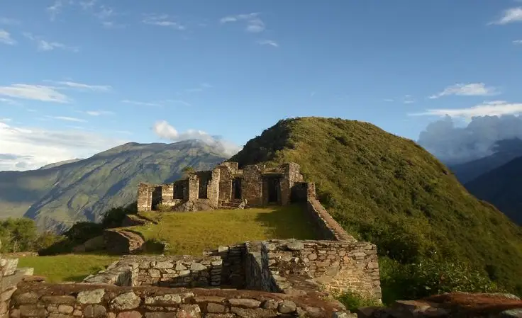
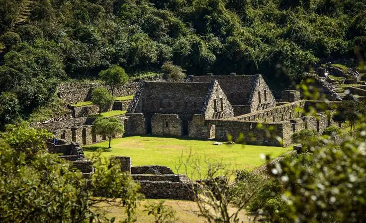
Choquequirao’s history is written not only in chronicles or explorer accounts, but also in its layout. The site includes terraces, plazas, platforms, channels, residential areas and ceremonial spaces. Together, they show a planned Inca center shaped by both practical needs and sacred meaning.
One of the most distinctive examples is Sector VIII, where white stone llama figures were built into darker terrace walls. Those figures are not a minor decoration; they show how architecture, agriculture and symbolism could be combined in one place. For travelers who want the specific story of this feature, the stone llamas of Choquequirao deserve their own closer look.
Did you know?
The famous llama figures are part of the terrace architecture, not separate sculptures placed later. That detail helps explain why Choquequirao should be read as a landscape of farming, ritual and movement, not just as a fortress.
Choquequirao and Inca Resistance
Choquequirao is often described as one of the last bastions of Inca resistance. That idea is important, but it needs precision. The capital of the last independent Inca state was Vilcabamba la Grande, deeper in the forested region. Choquequirao was not that capital, but it formed part of the wider political and geographic landscape connected to Vilcabamba.
After Manco Inca left Cusco and the resistance moved through difficult mountain and forest territories, sites like Choquequirao gained meaning because of their location. They controlled access, protected movement and stood within a zone that remained difficult for outsiders to dominate. Over time, that reality mixed with stories of hidden treasure, lost cities and the last Inca refuge.
| Common idea | Better historical reading |
| Choquequirao was the final Inca capital. | The final capital was Vilcabamba la Grande; Choquequirao belonged to the wider Vilcabamba landscape. |
| It was only a military fortress. | It likely combined ceremonial, administrative, agricultural and strategic roles. |
| It was completely forgotten. | Local memory and scattered references survived, even if the outside world ignored it for long periods. |
| Its history is fully known. | Much remains under vegetation, and interpretation continues to evolve. |

From Local Memory to Modern Archaeology
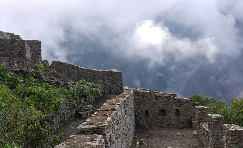
Choquequirao did not simply “appear” in 1909. Local people knew the area, and older references linked the site with the Vilcabamba region long before it became a modern travel destination. What changed over time was the way outsiders documented, mapped and interpreted it.
The 19th century brought explorers such as Eugène de Sartiges and Léonce Angrand, whose accounts mixed observation with the romantic imagination of lost Inca cities. In 1909, Hiram Bingham visited Choquequirao and documented the ruins before his famous Machu Picchu expedition. Later archaeological work, restoration and public interest helped bring the site into Peru’s modern tourism map.
Historical timeline at a glance
1710: early references connect the site with old Inca settlements in the Vilcabamba region.
18th century: written descriptions mention Choquequirao or similar spellings, but the site remains outside public attention.
1830s: European travelers and mapmakers help bring the ruins into wider scholarly curiosity.
1909: Hiram Bingham reaches and documents Choquequirao.
1970s onward: excavation, restoration and research gradually reveal more of the site.
Important note:
The phrase “rediscovered” is useful only if we remember who it refers to. Choquequirao was never absent from local landscapes or memory; it was rediscovered by outside explorers, researchers and later travelers.
How Much of Choquequirao Has Been Excavated?
Most references describe Choquequirao as only partially excavated, often using a range around 30% to 40%. The exact percentage can vary because the larger archaeological area, restored sectors and visible visitor route are not always counted in the same way.
For travelers, the important point is simple: Choquequirao still feels unfinished. That is part of its power. You see restored terraces and plazas, but also forested slopes, hidden structures and areas where the past has not been fully exposed.
| Excavation detail | What it means for visitors |
| Partially excavated | Large parts of the site remain under vegetation or ongoing study. |
| Visible sectors | Main plazas, terraces, channels and selected structures can be visited. |
| Interpretation still evolving | New research can refine how the site’s function and history are understood. |
| Less mass tourism | Access by trek helps preserve a quieter and more reflective experience. |
What Every Traveler Should Know
Knowing Choquequirao’s history changes the way you visit the site. The trek is physically demanding, but the archaeological experience is not only about reaching a viewpoint. You are entering a place connected with Inca planning, mountain worship, agricultural engineering and the memory of resistance.
This history blog should not replace a route guide. For distance, camps and trail difficulty, the Choquequirao hike page is the right planning resource. Here, the purpose is different: to help you understand why the place matters before you stand among its terraces.


Beyond the Ruins
Choquequirao is not frozen in the past. The surrounding valleys and mountain communities keep Andean traditions, agriculture and relationships with the landscape alive. That matters because the site is not only a monument; it belongs to a broader cultural and ecological territory.
The history of Choquequirao also reminds travelers to move with care. These trails and ruins have survived because of isolation, local knowledge, conservation work and the slow pace of archaeological research. Visiting them well means respecting both the stones and the people who live around them.
Main Trek Guides in Peru to Compare from Here
Walk Into the Story
Choquequirao history is not only something to read before a trip. It changes the way the journey feels. The canyon becomes more than a physical challenge, the terraces become more than stone walls, and the silence around the ruins begins to make sense.
If you want to experience that history with the right rhythm, Inkayni Peru Tours can organize the route with transport, camps, meals, mule support and a local guide who helps connect the trail with the story behind the site. The goal is simple: reach Choquequirao safely, understand what you are seeing and leave with more than just photos.
Frequently Asked Questions About Choquequirao History
Who built Choquequirao?
What does Choquequirao mean?
Was Choquequirao the last capital of the Incas?
Why is Choquequirao linked to Inca resistance?
Is Choquequirao older than Machu Picchu?
Why is Choquequirao called the other Machu Picchu?
When did Hiram Bingham visit Choquequirao?
How much of Choquequirao has been excavated?
What was Choquequirao used for?
Why is Choquequirao historically important for travelers?
Can you visit Choquequirao without trekking?
What should I read after this history guide?
Escrito por
Shared:


If you liked this article and the information you found, give us 5 stars!
 (Ninguna valoración todavía)
 Loading...